Written By

The Inland Northwest Fire Program is preparing two controlled burns at the Little Pend Oreille National Wildlife Refuge. Burning is planned to occur sometime between March through May depending on weather conditions. Burning will occur only when weather conditions are favorable on days when the smoke will disperse and mix with the predominant air flow. Controlled burns will be conducted in accordance with regional air quality guidelines.
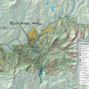
These burns are implemented to reduce hazardous fuel loading and to restore and enhance wildlife habitat. The map depicts the location(s) of proposed burning on the Refuge. Fire Program staff will begin controlled burning when the fuel and weather conditions allow them to meet burn objectives safely. Some controlled burning may be added, broken up into smaller units or delayed for another year.
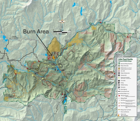
An accessible version of this map is also available.
Burn Units:
| Name | Acres | Township, Range, Section |
| Paulke | ~569 | 35N, 41E Sec 31, 33 34N, 41E Sec 6 |
| Starvation North | ~236 | 35N, 40E Sec 36 35N, 41E Sec 31 34N, 41E, Sec 6 |
For questions, contact Little Pend Oreille NWR Headquarters at (509) 684-8384 or Cassie Roeder, Deputy Project Leader, at (509) 559-3021.