What We Do
Our Services
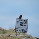
Enhancing Recreational Access
The Service strategically enhances the National Wildlife Refuge System by working with willing sellers and donors to conserve wildlife habitat and improve public opportunities for wildlife-dependent recreation, including hunting, fishing, and wildlife observation. Acquisition of inholdings also facilitates more effective land management by enhancing the Service's ability to conduct prescribed fire treatments, restore wetlands, and manage public use.
Cartography and Mapping
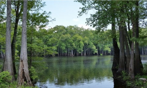
Cartography is the art and science of making maps. We rely increasingly on maps that portray the surface of the earth as well as the oceans. The first wildlife refuge maps were drawn by hand and reflected little more than a dashed boundary line surrounding the land and water being protected.
Today's Fish and Wildlife Service cartographers use computers and geographic information system (GIS) software to maintain geodatabases and produce maps that show refuge boundaries, federal land ownership within refuges, wildlife habitats, planned management actions, and public hunting and fishing opportunities, as well as Service facilities and permitted infrastructure. Realty cartographers maintain the maps used by all Fish and Wildlife Service offices to facilitate management including law enforcement, prescribed fire, and public recreation.

Land Surveying
Land surveys ascertain the physical location of lands under the Service’s administrative jurisdiction as well as that of proposed acquisitions and proposed infrastructure and facilities. This provides positive identification of the land, both on the ground and by written legal description. In the management of Fish and Wildlife lands, certainty of ownership is an important aspect, in which accurate, up-to-date land surveys contribute to the overall success of the Service in meeting its mission responsibilities.
Whether by review of the completeness of a land description or the physical survey of the lands to determine a precise location on the ground and an accurate acreage, land surveys generate required information to ensure good title to the lands of the Fish and Wildlife Service and ensure that proposed facilities and infrastructure are appropriately located. Properly established boundaries provide for better management of resources by accurately identifying the landscape's extent. The Service cannot provide effective management for public land unless we know precisely where the land is located.
Right-of-Way Permitting
The Service reviews and processes applications for right-of-way permits for infrastructure on refuge lands in accordance with the permitting regulations in 50 CFR 29.10. After a refuge manager determines that a requested right-of-way is a compatible use of the affected refuge, in accordance with 50 CFR 25.21, realty coordinates with the applicant and the refuge manager to prepare and obtain approval of a suitable right-of-way permit. Potential right-of-way applicants should contact the Service regional office for more information.
Land Records Management
To effectively manage the public lands and conservation easements within the Refuge System, the Service must know precisely where the land is located, what land rights the Federal government has, and what land rights a prior landowner might have retained before selling or donating their land or an easement to the United States. Records for these lands are maintained to help protect the interests of the United States and to help ensure that Service does not inadvertently infringe on the property rights of its neighbors.
Payment in Lieu of Taxes
The United States makes annual payments to counties and other local government units for certain tax-exempt federal lands through the Payment in Lieu of Taxes program. These funds are used by counties and local governments to help fund local government functions such as law enforcement, fire departments, and schools.
Refuge Revenue Sharing
The United States makes annual payments to counties and other local government units for certain tax-exempt federal lands (excluded from the United States’ Payment of Lieu in Taxes program) through its Refuge Revenue Sharing program. The Refuge Revenue Sharing program disburses funds collected from Service timber sales, grazing leases, minerals leases, and other compatible economic uses to local governments to help fund local government functions such as law enforcement, fire departments, and schools.