
Photo By/Credit
Geoff Bedrosian/USFWS
Date Shot/Created
10/10/2024Media Usage Rights/License
Public Domain
Image
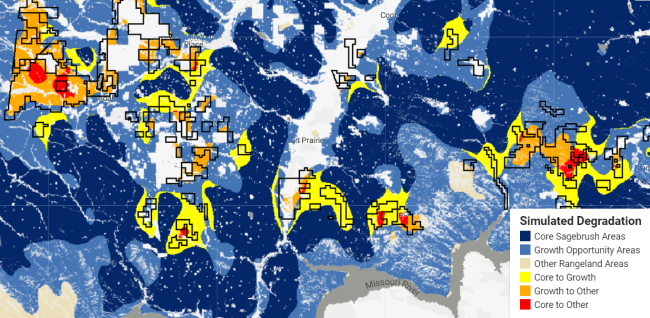
A map of southern Phillips and Valley counties showing results of Bedrosian’s simulation model predicting degradation in the Sagebrush Conservation Design’s classes in and around existing conservation easements (black outlines) if they were to be converted to cropland.