
Photo By/Credit
USFWS
Date Shot/Created
04/24/2024Media Usage Rights/License
Public Domain
Image
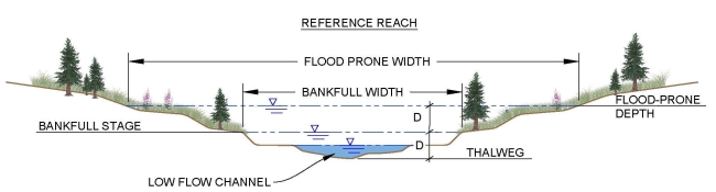
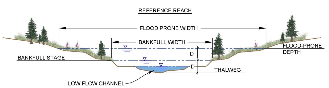
A cross section of a reference reach showing a bankfull channel and the adjacent floodplain. The flood prone depth and width is derived from a horizontal line drawn at times the maximum bankfull depth and the intersection of the natural terrain.